

On a Monday morning in August of 2015, a 4.0-magnitude earthquake hit the San Francisco Bay Area just before 7 a.m. I was living in Oakland at the time, near the epicenter of the temblor, and I woke up to the sound of my janky IKEA bookshelf moving back and forth. When the shaking stopped, I immediately checked social media sites for updates.
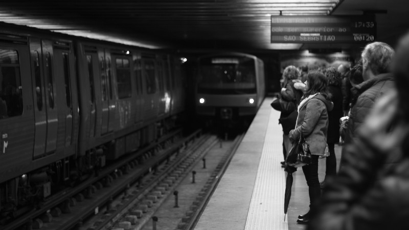
Happily, no major damage was reported, but the Bay Area Rapid Transit System (BART), the region’s subway system that allows those who live in the East Bay and other areas to commute into San Francisco, had stopped service while the tracks were inspected. Service delays disrupted the commutes of people heading into work, and those people complained. To an outside observer, BART may have seemed unprepared for an earthquake or emergency. In reality, the transit agency was ready and waiting.
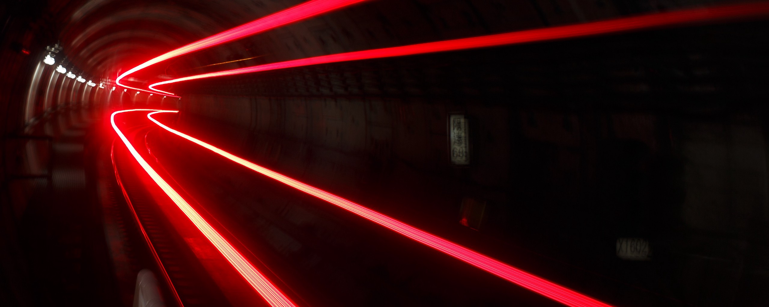
BART is currently the only transit agency in the United States using an early warning system that responds to earthquake alerts, automatically slowing trains when a tremor is detected. Other cities are testing similar technology, but the U.S. lags behind several other countries when it comes to protecting its public transit passengers from natural disasters.
Mexico, Japan, China, Romania, Turkey, and Taiwan already have some form of an earthquake early warning system. Mexico, which has the oldest system in the world, decided to build one after the country’s deadly 1985 quake. Japan’s is one of the most advanced; it can send alerts to residents’ cellphones seconds before the shaking begins, and sensors along rail lines can automatically halt even high-speed bullet trains.
Of course, other natural threats like hurricanes, floods, avalanches, and extreme temperatures also impact transportation. Climate change will only increase the frequency and risk of these types of incidents. Coastal cities such as New York will also need to find ways to combat rising sea levels.
Thinking about what could go wrong in the future is becoming necessary for public transit agencies, especially those that have faced extensive damage and costly repairs following a disaster.

The story of BART’s quake warning system begins above five years ago. That’s when the agency became a pilot user for ShakeAlert, a system being developed by the U.S. Geological Survey (USGS) in partnership with several universities and the states of California, Oregon, and Washington.
Earthquakes are one of the most difficult natural disasters to predict in advance. ShakeAlert and other warning systems can only send out alerts once seismometers in the ground detect the preliminary waves coming from the point on the Earth’s surface where a quake begins, called the epicenter.
But even mere seconds of warning can save lives. Those who commute daily by subway or train could receive an alert before boarding. It’s enough time to slow or stop trains, get out of a dangerous location, and prepare for shaking. Imagine waking to an alert on your phone a few seconds–or perhaps a whole minute, depending on where you are in relation to the epicenter of the quake–before the furniture in your room starts to move.
In August of 2014, the Bay Area was hit with a more significant quake. It was centered in South Napa, approximately 50 miles from San Francisco, and damaged more than 1,500 buildings. Two people died and around 300 were reported injured. The shaking began at 3:20 a.m., a few hours before BART service started on a Sunday, but the system’s computers received an alert seconds before the earthquake began. The warning system worked, but there were no passengers.
ShakeAlert is still in development. The program is aiming to begin a limited rollout sometime in 2018. The date for a complete rollout to residents in California, Oregon, and Washington is undetermined, but nearly 100 groups across the West Coast currently act as beta testers. BART is one of the first testers to develop a plan for taking action in response to the alerts.
“They definitely see themselves as an important part of the resiliency for the Bay Area after an earthquake,” says Jennifer Strauss, an external relations officer at the Berkeley Seismological Laboratory at UC Berkeley, one of the partners for the early warning system. “They can move both people and goods in and out of an area. They’re kind of a flagship for what other transit agencies in the West Coast can do.”

While BART is being proactive, other transit agencies have only begun addressing the risk of natural disasters after they’ve struck. In October of 2012, Hurricane Sandy seriously damaged public transit systems in the Northeastern United States. Nine underwater subway lines were affected in New York City. Salt water poured into the tunnels, wreaking havoc on electrical equipment, tracks, and other infrastructure. More than five million people who take the subways during the week were left without service for several days. In New Jersey, service on the PATH rail, which takes commuters into New York City, was also suspended. Normal weekday service wasn’t wholly restored until late January 2013, a full two months after the storm.
The immediate goal for transit agencies following the storm was to pump out water from flooded tunnels and restore service to customers; but now they’re looking for long-term solutions. Affected tunnels, like the one used by the L line, must undergo an extensive recovery effort to repair the damage from Sandy and protect the system from future natural disasters. To fix the damage, NYC’s Metropolitan Transit Authority (MTA) will install new tracks, signal and communication cables, and a lighting system during the tunnel’s closure.
Unfortunately, doing this kind of work takes time. The popular L line, which takes passengers under the East River between Manhattan and Brooklyn, was one tunnel that sustained severe damage. Instead of closing the subway line intermittently over a period of several years, MTA has opted to shut down the line completely for a year and a half, starting in January 2019, and complete the work all at once. PATH instead chose a plan that interrupts some weekend service through 2026.
Future projects to fortify NYC’s transit system will close up areas where water can leak in, such as manhole covers and hatches for emergency exits. Delaware-based ILC Dover–the maker of space suits for NASA–is designing floodgates for the stairwells of NYC subways.
Sandy was a Category 1 hurricane–the wind speed was between 74 and 96 m.p.h.–when it hit the Northeastern U.S. All of the post-Sandy repairs are intended to shield the public transit systems in New York City against a more dangerous Category 2 storm, says MTA spokesperson Kevin Ortiz. While some of these long-term repairs are still in progress, the MTA is more prepared for a hurricane or flood today than it was during Sandy, he adds.

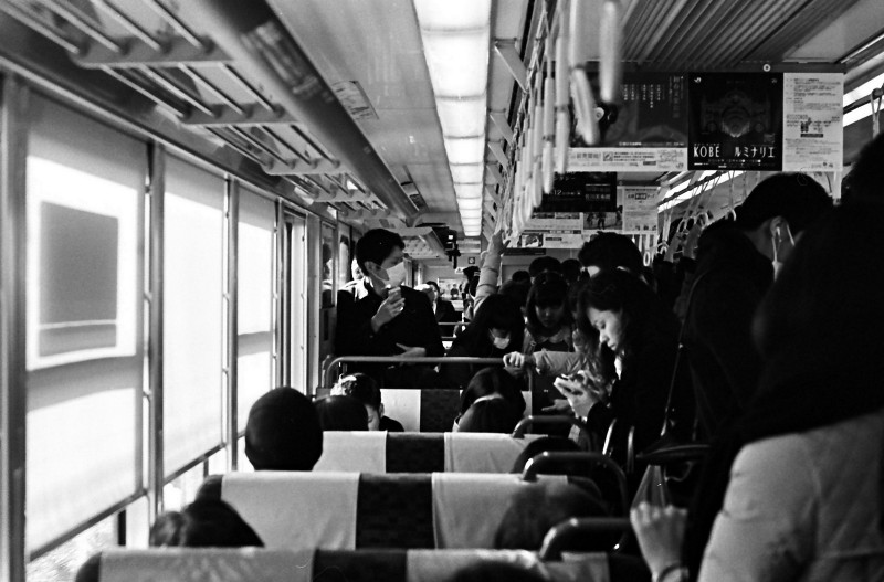
Japan’s Shinkansen high”speed bullet trains are a great example of how other countries are thinking about natural disasters when designing public transit systems. Seismometers are installed along rail lines, and trains are connected to an earthquake early warning system, which detects the fast-moving preliminary waves (p-waves) that travel from an earthquake’s epicenter before the slow-moving, damage-causing secondary waves (s-waves) arrive. The trains respond to the p-waves, leaving time to stop the trains before the s-waves hit.
This is the same technology found in other earthquake early warning systems, including the ShakeAlert system mentioned above. The difference, however, is that Japan’s nationwide system, which the Japan Meteorological Agency (JMA) launched in 2007, includes more seismometers and a public alert system that reaches residents though radio, TV, and cellphone alerts. Additionally, if there is risk of a tsunami following a quake, JMA sends out an alert to coastal regions.
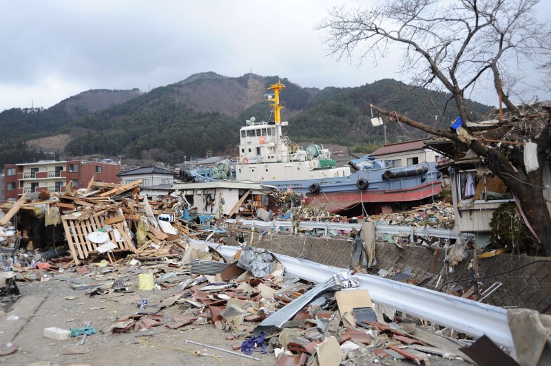
The system proved itself in 2011, during the 9.0-magnitude TÅhoku earthquake and tsunami which devastated vast areas of the country. Electricity was cut on the Shinkansen lines and emergency brakes were activated on the trains, which can reach speeds of 200 m.p.h. No trains derailed, and no passengers were injured.
Earthquake early warning systems are most effective for areas far away from the epicenter of the quake. In 2004, eight out of 10 cars on a Shinkansen train derailed during the Chūetsu earthquake in Niigata Prefecture. That train was too close to the epicenter to stop before the shaking begun. Still, the 154 passengers onboard were not injured. Now, Shinkansen trains are equipped with special safety devices to prevent derailment.
Other features on the trains include rain gauges, sprinklers to wet snow, and snow blowers. Anemometers installed at specific locations measure the speed of wind, and alerts are sent to Shinkansen stations if high wind speeds are detected. The average delay time for Japan’s bullet trains is less than one minute, which the service credits to its training and protocols for responding to disasters.
India is scheduled to start work on a bullet train, which will travel underwater for a short portion of the 315-mile-long route, in late 2018. A high-speed rail system that links Singapore and Kuala Lumpur is underway. A private firm wants to build a bullet train in Texas between Dallas and Houston, and work on California’s high-speed train is slated to begin soon, though the project is currently facing opposition from House Republicans. It may take many years, but when the railway is finally built, it will need protection against earthquakes and storms.
As these cities, and others around the world, make plans to install new bullet trains, Shinkansen could become a model for how to equip trains to respond to natural disasters. It certainly has a great track record–no injuries or deaths in 50-plus years from derailments or crashes.

Los Angeles is a city known for its car culture, but it’s home to a growing subway and light rail system that more than 300,000 people use on an average weekday. Last year, the Los Angeles County Metropolitan Transportation Authority (LA Metro) opened an extension to its Expo line that allows residents to travel from downtown Los Angeles to Santa Monica by train–usually a grueling ride in a car during rush hour.
As more people in L.A. begin to commute by train rather than by car, an early warning system that connects to the agency’s rail lines will become vital in the event of a major earthquake–which is sure to happen at some point in a region with active fault lines.
LA Metro is also a ShakeAlert partner, and the agency works with a Santa Monica-based tech company called Early Warning Labs (EWL). The company has built a cloud-based application to deliver earthquake early warning alerts. Rail controllers at LA Metro receive these alerts and then decide whether to slow trains or stop service. Unlike BART’s system, LA Metro’s trains do not automatically respond to the alerts and require human intervention.
Josh Bashioum, the founder and principal investigator of EWL, tells me that his earthquake early warning system would “help mitigate a tremendous amount of risk of downtime associated with transportation after a large earthquake.” With a warning of up to a minute, the West Coast could bounce back more quickly after an earthquake, he says.
EWL began developing its product three years ago as an iOS app. Now the company works with ShakeAlert and is hoping to improve on existing early warning systems. Bashioum says he’s always looking for new pilot participants and other West Coast transit agencies that are interested in testing out the alert system. He’s also open to working with foreign governments on its technology.
But putting EWL’s technology into the hands of real people in the West Coast and beyond is a slow process. Development for the ShakeAlert program began over a decade ago. The program relies on hundreds of ground sensors that make up a seismic network expanding from the southern end of California all the way up to the Canadian border. Those sensors feed into the ShakeAlert system and create the early warning alerts when an event occurs.
Current users receive alerts that show a map of the earthquake’s epicenter and the time remaining until shaking will begin in the user’s location. Before the program rolls out to residents, it will need to add many more sensors, which cost money. The price tag on the whole program is $38 million, and it would cost around $16 million per year to run across the West Coast.
A warning system is useless if people don’t know what to do with it. People must be trained and educated in the use of any emergency alert system before it can be rolled out. What would you do if you received an alert that said an earthquake, or other natural disaster, was approaching your location in a matter of seconds? Some people would run, others would stay in place.
The ShakeAlert program wants people to know how to seek cover before they receive an alert. A study of the 2011 earthquake in Japan found that millions of people were able to take action to protect themselves and the lives of others after receiving an alert seconds before the event. “This high rate of effectiveness is assured to be the result of education regarding the [early warning] system, both in schools and in society at large,” wrote the study’s authors.
Strauss says that it’s vital to make sure the U.S. system is reliable and everyone knows how to use it before it’s released to the public. “We’re very cognizant that we’re building an infrastructure project that people are going to rely on for years to come,” she says. “We have to do it right and make sure that people have confidence in the system.”
No country can prepare for every disaster, but there are first steps to take. Recognizing that regions with active fault lines need to protect transit systems from earthquakes. Recognizing that our climate is changing, and hurricanes and rising sea levels threaten transportation. Taking proactive steps to harden systems against future disasters.
Improvements to heavily used public transit systems, especially those fixed to a track or located inside a tunnel, will go a long way toward preventing both passenger injuries and crippling damage to infrastructure. Cities will spend less time rehabilitating public transit systems after an emergency, and that means they can focus on other relief efforts. It won’t be cheap, but efforts to protect riders–either through updating existing systems or building technologically advanced, new systems–will pay off.
People who rely on public transportation to get to most destinations, like myself, want to be able to travel without worrying that a train will derail or water will gush into a subway station. Just worrying if you’ll make the train is enough.

How We Get To Next was a magazine that explored the future of science, technology, and culture from 2014 to 2019. This article is part of our Going Places section, which looks at the impact of transportation technology on the modern world. Click the logo to read more.